mountaineering

Ricoh GR Digital – Climbing Review

Fuji GA645wi Ricoh GR DigitalOne reason I bought the Ricoh GR Digital (GRD) was to use as a climbing and mountaineering camera. What follows is a user review and my impressions of the GRD in the mountain environment.

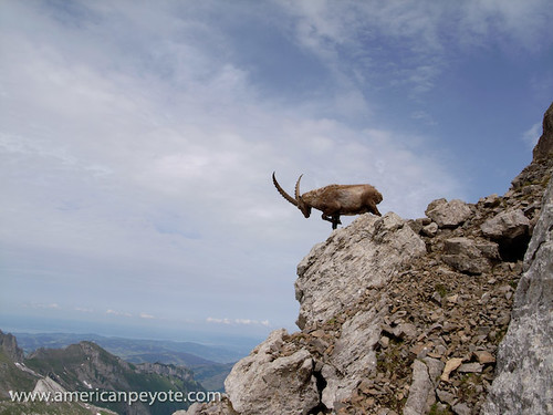
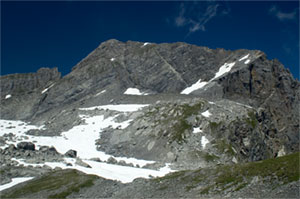
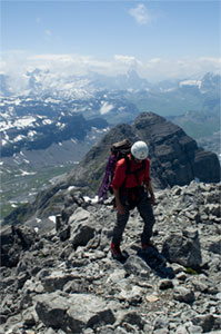
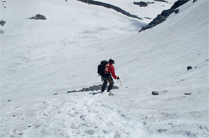
I live in Switzerland and mountain trips are frequently on my schedule. A basic day trip involves an elevation gain (and equally large loss) of 800-1200 meters, and involves hiking, rock scrambling or sections of actual climbing. This means that any weight savings makes a difference in terms of how fast and how far I can go on any given trip. It also means that if I want to use a camera, I don’t always have the benefit of using two hands when taking a picture. Sometimes trips just need to be documented, a shot for the blog, or just to record the day. Other times I go with the intention of bringing back some good-looking, printable photos. My current list of cameras includes: Contax G1 (28,45,90mm lenses), Fuji GA645, GA645wi, Minolta 7D.

In general, none of these cameras have been ideal in the mountains, although the Fuji GA cameras come pretty close to being perfect for landscapes. The Contax G1/G2 is a good choice, but if I’m just documenting a trip, then I don’t need or want to go through the costs of processing 35mm film, and then taking the time to scan the images. Plus, while 35mm film can produce some very nice detail and colors, it leaves me wanting more for landscapes. The Fuji GA645 and GA645wi are my favorite film cameras for mountaineering, but (aside from the developing costs) they don’t have a close focusing distance, which only makes them good for landscape shots, and is not ideal for focusing on close objects. The Minolta 7D is great, but generally needs to be accessed from my backpack and can’t be comfortably held with one hand for shooting purposes. Plus, a 7D with lenses is not a light kit to carry into the hills.

Climbing Ricoh GR Digital GRDFrom a certain perspective, the Ricoh GRD was seemingly made for mountaineers. The fixed 28mm and 21mm add-on lenses are ideal for landscapes and the camera is incredibly compact. In fact, it’s not a stretch to call the Ricoh GRD (and GRD-II) as well as the GX100/GX200 some of the most compact wide-angle cameras on the market. In addition, the GRD is incredibly light. The Contax G1/G2 is also a compact camera, but it isn’t really light from a pack-weight point of view.

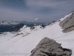
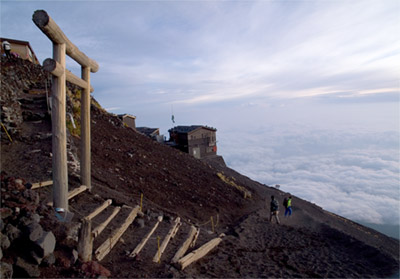
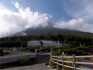
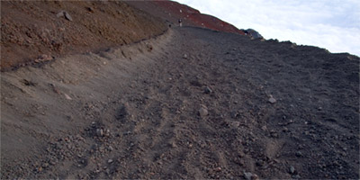
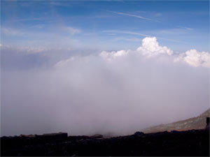
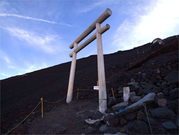
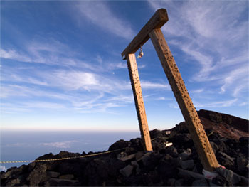
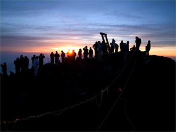
My first mountain trip with the Ricoh GRD was up Mt. Fuji in Japan, where I also took my Fuji GA645wi. The Ricoh performed wonderfully, but since Mt. Fuji can’t really be considered more than a hike, it wasn’t until I got back to mountaineering in Switzerland that I could get a feeling for how the GRD performs in a mountain touring environment, which is the focus of this article.

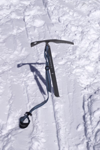
To date, I’ve taken my GRD ice climbing, mountain touring in Graubünden, hiking up Säntis in the Alpstein, and climbing on a klettersteig in Braunwald. I plan on ascending some higher peaks and undertaking some longer tours soon and think the GRD will be up to snuff. There are a few main criteria I’ll be focusing on including how well the GRD can be operated while climbing, it’s attributes such as the LCD screen, and creating good exposures in the mountains.

Braunwald Klettersteig Ricoh GRD
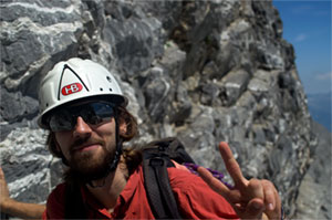
Operation – One of the GRD’s strengths has always been customization and user control. I can hold the camera up to a scene, automatically see if the histogram looks good, and if not, two small clicks on the exposure compensation button and I know I can take a picture without blowing away the highlights. Similarly, the ISO, focusing mode, file type/size, shutter speed, and aperture can all be changed within a few seconds using one-handed operation. I can’t do that with any other camera I own without the risk of dropping the camera. While seemingly unimportant or at best a convenience for city use, when one hand is holding onto the mountainside, one-handed operation really does make the difference between possibly falling or getting the shot I want. With the GRD I can easily have my left hand secured on a handhold while operating the camera with my right hand.

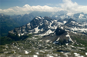
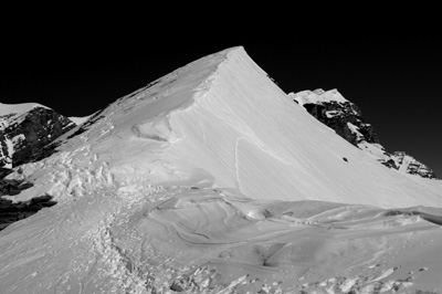
Image Quality – As a small sensor camera, the Ricoh GR Digital obviously can’t compare with DSLRs or medium format film cameras for image quality. However, you don’t always need a perfect landscape image worthy of pixel-peeping. For trip documenting and small prints, the Ricoh GRD does pretty good. When the images are exposed correctly the contain a great deal of detail and you won’t have a problem creating large prints. Small sensor camera image quality degrades as ISO increases, however, in the mountain environment you generally have more than enough natural sunlight to create exposures with shutter speeds above 1/200 using ISO 64 (the base ISO of the GRD). Since these landscapes will nearly always be with a low ISO, noise won’t be much of an issue. I love the colors I get from GRD files and so long as the images aren’t over-exposed you’ll be pleased with the results.

Braunwald Towards OrtstockRAW Write Time – This is by far the greatest drawback of the original GRD. When deciding to buy the GRD, one of the biggest draws was its ability to write RAW files at a time when pretty much every other pocket camera would only do jpeg. Depending on SD card type, the time to write a RAW file is about 9-12 seconds using the original GR Digital. Many users have produced reports detailing which cards write faster, but generally the difference is only a few seconds at best, and the three cards I have all write at different speeds. Depending on your shooting style, for landscape use the RAW write time is sort of irrelevant. With the exception of creating multiple images for stitched panoramas, I haven’t found the long write time to be a significant problem for landscape images. On the other hand, when you’re moving fast over a mountain landscape and trying to document the climb, I would no doubt love the improved RAW write time of the GX100/GX200 and GRD-II, which from what I read are on the order of 4-5 seconds.

Battery Life – At least with the GRD (not considering the GRD-II as I haven’t used one) the battery life and performance could be better. I find that I’m always getting low by the end of a climb, and although I always carry a second battery, this is one area that I would like to see improvement in. For multi-day trips nothing sucks more than running out of juice, which is one reason I still love my Fuji GA and other film cameras, as I’ve never had a similar battery problem. Cold also seems to be an issue, and hampered by ability to use the GRD while ice climbing during December.

LCD Screen – The LCD screen on the GRD leaves much to be desired in the mountain environment. It just sucks in bright sunlight, and is only good for framing the subject. I do have the external viewfinder, and I’m glad I bought it, but don’t use it very much in the mountains. Since the live histogram is available (and easy to see in sunlight), I’m of the opinion that having a perfect image on the LCD screen isn’t really a big deal. More exact framing can be accomplished with the aid of the external viewfinder. Here’s the thing, If you can monitor the histogram, you know if the highlights will be blown and can adjust the exposure as you like. It doesn’t really matter if you have a bright, perfectly defined image when framing a shot. Often times upon review, the images on the GRD LCD screen look extremely dark in bright sun, but when reviewed later indoors, the images are perfect. As long as you base your exposure on the live histogram, the quality of the image on the LCD is somewhat unimportant. The lack of a live histogram display is one big reason I’ve decided not to buy the Sigma DP-1. The live histogram is invaluable in producing well-exposed images the first time, and eliminates the need to reshoot a scene. It’s one of the things I love about digital cameras to start with, and the primary reason I want live-view in the next DSLR I buy (probably the Sony A900). As the DP-1 lacks this seemingly basic function, I’d rather take a Fuji GA rangefinder on a climb.

Edelweiss in Braunwald Ricoh GRD
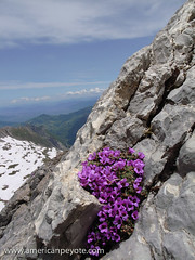
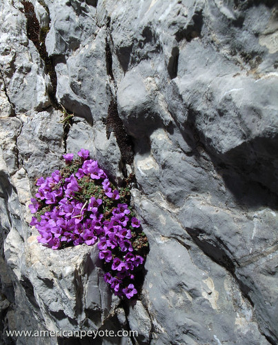
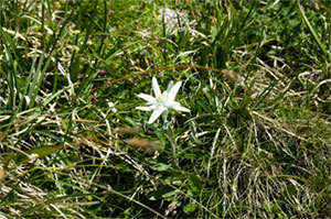
Macro Focusing – This is where the GRD really beats all my other cameras and is one big reason why I love climbing with it. You can get as close as 1cm from your subject to create sharp macro images of anything on a tour whenever you feel inspired. You might just think this is great for flower shots – and it is, but what I love is creating wide-angle macro shots during climbing for point-of-view (POV) images. I love getting the Ricoh close to my equipment or looking out over rock edges and creating unique shots that I haven’t seen before. The only way to get similar images with my current equipment is using my Minolta 7 film camera with the Sigma 20mm lens (very close focusing ability), which also is rather large, heavy, and also produces images with just a bit more distortion than I would like. Plus, with the Sigma 20mm you have a much shallower depth of field and a lot of Bokeh (diffused image areas), which isn’t a bad thing, but at the moment for climbing, I like close-up images with a good deal of sharpness across the image. With the small sensor of the GRD, you get really deep depth of field, and combined with the 28mm lens and one-handed operation, this means the ability to take crisp images that are more or less unobtainable with other camera systems.

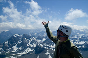
Compact Size – This is one of the main requirements for a mountaineering camera, it needs as small and light as possible. The GRD is great because I can put it in a case and clip it to the chest strap on my backpack. This keeps it away from my carabiners or quick-draws, and is accessible whenever I want to shoot. It also means it won’t interfere with my climbing movements.

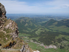
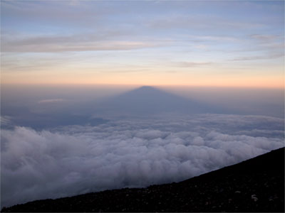
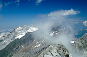
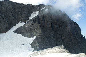
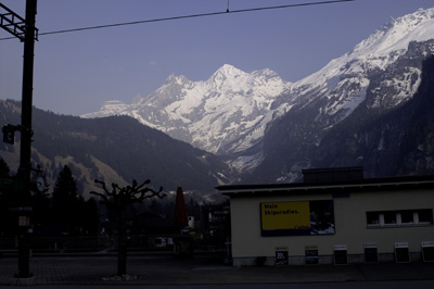
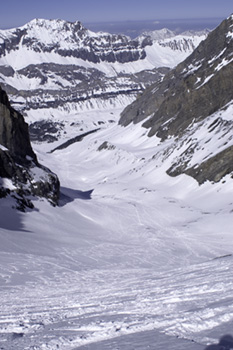
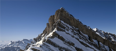
Wide Angle Lens – The lens on the GR Digital is very good, as has been reported elsewhere. I have the 21mm add-on lens, which supplements the fixed 28mm lens. The wide angle still sets the Ricoh apart from other compact cameras. Even the top of the line Canon G9 only has about a 37mm (in 35mm terms) lens, which is not ideal for landscapes. Distortion is very low and the lens will render a sharp image across its entire frame. For mountain landscapes, and in particular for climbing, the wide angle lenses on the GRD are unique and much more useful than those of competing cameras. Using the wide lens of the GRD I’ve been able to obtain shots in the mountains that would not have been possible otherwise.

Braunwald Klettersteig Bridge

So, Why Do I Take My Ricoh GRD Mountaineering?

Great image quality
Unique macro image ability
Low weight
One-hand operation
Live histogram display

What Needs Improvement?

Battery life
RAW write time
LCD screen performance
Image stabilization would be nice

The strengths far outweigh the drawbacks of the GRD. It remains a high quality, extremely packable digital camera. If you’re in the market for a climbing and mountaineering camera, I highly recommend one of the Ricoh designs, including the GR Digital, GRD2, GX100, and GX200. In addition to using the GRD as a traditional landscape and portrait tool, it also works well for off-camera lighting, and I plan to do more trips packing the GR Digital with a small strobe flash and radio triggers.

Further Reading:

Ricoh GRD Articles

Hiking Mt. Fuji with the GRD

Fuji GA Camera Articles

Ricoh GR Digital Mountianeering

Santis – Mountaineering and Strobes

June 1st was a sunny Sunday in the Swiss-German land, and seemed like the perfect day to begin my return to the mountain environment.  On another sunny day in April, the 28th to be exact, I’d sweated through my dissertation defense, and after jumping from Zurich to Amsterdam, to Zurich to New Orleans to Detroit, to Boston, to Detroit, and finally back to Zurich, I found myself unemployed and in need of a mountain tour.

Santis-2
So on a sunny Sunday, the first of June, I headed out for a tour up Santis, the iconic mountain massif floating in the green landscape of Appenzeller, the heart of Swiss-German speaking peoples in Switzerland.

Santis is one of those mountains that people grow up with, starting with hikes as children and continue into old age.  This was something like my 5th trip up the mountain, and the first early summer ascent.  It was also an introductory trip for Matt Anderson, the Seattle mountain guide-turned Zurich-based commercial photographer.

I’ve photographed Santis in Summer and Winter, blanketed in snow and covered in wildflowers.  However, I’ve long since grown bored with basic landscape shots, the type perfected on postcards sold all over Zurich.  So to make the trip more interesting I packed along some off-camera lighting gear.

Route Up Santis
The essential problem with mountaineering and photography is the weight trade-off.  In the Swiss Alps every once counts, and as your desire to include cameras, flashes, and light modifiers goes up, your physical mobility in the mountains decreases.

A normal hike in the Swiss hills generally means a minimum elevation gain of 1000m, and by the time you finish the tour, the elevation gain over summits and passes adds up pretty fast.  So, in principle it’s ill advised to take more than a DSLR and a lens or two.  My photo and lighting kit included a Fuji GA645wi, a Ricoh GR Digital, Sunpak 383 flash and Gadget Infinity radio trigger.

The Ricoh GRD has proven itself many times as more than capable with it comes to off-camera, or Strobist flash techniques.  Choosing the Ricoh dramatically minimized the weight penalty as compared with packing my Minolta 7D DSLR with a macro lens.  The Fuji was used for basic landscape shots. 

Santis-7
Off-camera lighting on a mountain side isn’t so easy.  After you’ve ascended 1000m the body is shaking a bit, and when you’re on a rock ridge, it’s not like there’s any place to set up light stands.  I put a Gadget Infinity radio trigger on the Ricoh GR and held the Sunpak 383 at arms length from above the wildflowers growing on the mountain ridge.  In a few minutes and a little exposure management I could balance the landscape exposure with the flash lighting the flowers.  Wham!  Bahm!  And there we have a mountain photo I haven’t seen in the postcard stand.
 
Santis-5

In early June there are few people making the ascent up Santis, mainly due to the snow, which covers most of the Alpine route.  Many people will ascend with nothing in the way of mountaineering equipment, but I recommend taking crampons and an axe, because slipping on an exposed snow-covered 50 degree slope on a Sunny June Sunday is probably as stupid and just as deadly as putting a bullet in your brain.

Santis-13
Santis is a tamed mountain.  There’s a weather station at the summit and Steinbock have long since lost any fright-or-flight instinct.  The animals roam the Santis as they like and have no fear of humans, which means it’s pretty easy to make some of those iconic mountain wildlife shots.
Santis-14
Well, the Steinbock have one predator – avalanches.  And if you climb up Santis in early Summer don’t be surprised to find a decayed carcass or skull in the snow.

Lazy Tokyo Weekend – Mt. Fuji

Mt. Fuji, Fuji-san is possibly the easiest and most awestruck climbs I’ve ever done.  The term "climb" is a stretch when describing Fuji-san.  A winter ascent up the iced face might warrant crampons and axes, but a summer/fall experience falls into the hiking category.  The pathway is wide and primarily maintained with heavy machinery, and during the official climbing season, you can buy food and drinks along the way.  I climbed Fuji-san the third weekend of September, just after the close of the official climbing window of July 1 to August 27.  I’d been in Tokyo for about two weeks and my body and soul were screaming from some escape from the manic metros and crowded Shibuya streets.

Mountaineering has historically had a certain man vs. nature connotation.  Climbing magazines like Rock and Ice or Climbing sometimes use the terms assault to describe a person ascending to a mountain summit.  Popular culture uses terms such as conquer when to romanticize the act when a climbing team attains the summit of Everest.  But to say that one has attacked or conquered a large body of earth such as Fuji-san by the simple act of standing on the summit is like saying that the mosquito which buzzes near your sweaty head has made you it’s bitch.  Even the Swiss Alps with their cable ways and hotels and huts have not been conquered by mankind.

Despite the explicit traces of humankind and the rampant tourism and gimmicks associated with an ascent of Fuji-san, all the reverence and sacredness of the highest mountain on Japan, forged in the ring of fire, and risen from the sea like a God of old…none of these things are diminished by the fact that you can buy Fuji-Inspired custard snacks.  The gimmicks don’t make the mountain anything less than it is, one of the beautiful places on Earth.

I left Tokyo early in the morning.  Normally one can catch a bus from Shinjuku, but I waited too long to reserve a seat and had to find my way there by train.  I pick up a rice ball and yummy looking lemon drink.  It had a funky taste, something in between sour and fire.  After downing half the can I looked and noticed that the funky lemon can of liquid was 7% alcohol.

You can start the hike near sea-level, but I, like nearly everyone else started from Kawaguchiko-guchi Go-gome (Kawaguchiko Fifth Station).  It’s a bus stop and tourist trap, and signifies the start of the trailhead up to the summit.  The 5th is like any other tourist pit between the Mystery Spot in Northern Michigan or the Edelweiss-inspired shops in Grindelwald selling Swiss chocolate and cheese and kitsch.  You can get a can of fresh Fuji-san air at the 5th station, just like you can buy a sealed can of cosmic mystery in Sedona Arizona.

The most popular product is the walking stick.  During the summer you take the stick with you and get it stamped at each station.  I opted not to pick one up, partially because it would be hard taking back to Zurich, also because I was tired of spending Yen, but primarily because I would have entered into a Samurai fighting fantasy and ended up hitting someone by accident.

The real draw of Fuji-San is that everyone who can reasonably walk can make it to the top.  If you’re not in prime altitude condition, you can bring along an oxygen canister (available at the 5th station).  I highly recommend visiting Fuji in the early fall, there are fewer transportation possibilities, but there are far fewer people and the shops along the trail to the peak are closed.

The hike up Fuji-san is uneventful at first.  You begin to rise from the forested slopes and move over some rock, passing huts here and there.  You wonder why you’re ascending and wasting time on this man-conjured joke until the moment you pass through the cloud curtain and see the world falling away below you.  At this point the Zen begins to set in, and you are propelled upwards with a deep sense of wonder, each step a prayer to the deity whom you are set to meet on the summit.

There are a number of station up to the summit, I have no idea when I passed which ones, I really didn’t care.  All I needed to mark my ascent was the continued view of my vantage point getting ever closer to the sky.

In the Ying of the Yang, there is no sunrise without a sunset.  The many visitors will do a night hike and arrive at the summit for the sunrise, and the mountain is a bustling highway at 5:50am.  But at 5:50pm there are only a few souls, those who haven’t found a hut for the night or already descended.  I can’t recommend the sunset enough.  The popular gimmick is the sunrise, but in my experience it in no way matches the calm magic of the sun falling behind the summits.  The clouds gather in full at the slopes and form the perfect curtain for the shadow of the mighty one to be projected upon.

I thought about descending after the sunset and finding one of the huts to stay at for the night.  The cost for one of these runs around 60-80,000 Yen, and for some reason I just didn’t feel like putting myself back into the confines of walls and windows.

The cold was creeping over the ridges and rocks like it always does in an alpine environment after the sun leaves.  We get used to the comforts and confines and forget how vulnerable we are in the world.  I alternated between sitting and trying to sleep for a few minutes near rocks and walking around the volcano craters to move and stay warm.  This also allowed me to see the sky as I never had before.  The moon rose and set and the sky was filled with stars and at other times guarded by clouds.  It was quiet and cold and I’ll never forget the wonderful sleep depravation on the summit ridges and volcano rims of Fuji-san.

I was shivering at 4am when the first night hikers crested the over the last gate and began looking for the best place from which to see the rising sun.  You can see the sunrise from everywhere, but I opted for the more popular location, along with most everyone else.  The view is filled with cigarette smoke and the light of cell phones screens burns into the eyes as you wait for the sun.  The sunrise starts very slowly.  The sky lightens, and slivers of red start burning themselves into the atmosphere.  Eventually the red eye looks out across Japan and rises up above the clouds which have come to gather around the lower slopes.

The trip up and down Fuji-san was a wonderful experience.  It was a trip in the most spiritual sense, the way from Tokyo, finding the train, getting to the 5th station, watching the sun set and the stars revealed, the moon set and the sun rise and the eventual return to Shinjuku.

For the inexperience mountaineer Fuji-san is a colossal trek, an adventure of one’s lifetime.  For the lazy sometimes seasoned mountaineer such as your humble narrator, Fuji can be done as a day trip if desired.  One just needs to make sure of the transpiration issues.  Camping is officially prohibited, but like in the Swiss Alps, if you do and no one else is around, there’s no one to tell you to stop.  A number of travelers set up tents on the summit during the night, although I think this is only in the off-climbing season.  Either way, I highly recommend it for those in Tokyo seeking an escape from the manic rhythms of the city.  It is a majestic climb, no matter your skill level or previous mountain experiences.

Specifics on the climbing routes up Fuji-san can be found at the SummitPost page.  Photos and images from this trip were produced with the awesome Ricoh GRD digital camera.

Ricoh GRD Review
Ricoh GRD and Strobe Lighting

Lazy Swiss Sunday – Bos Fulen

10,000 years ago, in the hunter-gatherer sense of our history, moving and beating the body to it’s core was needed for survival, so it is no surprise that some humans are not yet evolved enough sit in an office every day.

Bös Fulen is neither incredibly difficult, nor is deceptively easy to summit.  It’s the mountain to climb when you need to get away and are looking for a nice green – field – glacier – alpine climb for the day.

The starting point is Braunwald, situated at just over 1256 m it’s accessible by train in about two hours from Zurich.

Along the way we walked through the green fields and yellow and purple alpine flowers and came upon a group of four edelweiss.  The reclusive Alpine flower is placed on pretty much everything from hotel names, climbing stores, airplanes, and most souvenirs from Appenzeller, but are so rare that most people have never seen them in real life.

The summit of Bös Fulen is reached at 2801 m, after first climbing the glacier as high as possible, followed by free climbing the rock face.  You might find an old rusted piton here and there along the climb, but the hand holds are enough for one to feel secure.

There’s a bit of a scree field before the summit, and the keen climber will wait for those teams climbing ahead to summit before following the same line.  The alternative is to duck falling rocks and pray that one doesn’t take your fool head off.

Although it looked like a rather exhausting climb from below, the actual ascent was probably only like half an hour.  The hand-holds are bomber and the foot edges are wide enough to dance on.

The view from the summit is rather spectacular.  All the eastern alps are around, the klettersteig up Eggstöcke, the Glärnish Massif, Clariden and Ortstock.

Once in a while I get the feeling that mountaineering is for those who have realized the presence of their mortality, but not yet seen the wisdom in standing far away from the divide to this life, for one who needs some measure of sustenance to keep their fool unevolved spirits in line.

For the descent we traversed along the east ridge and then down the slope.  If you go too far you might notice the 1000 m drop down the east face, we didn’t stray too far and then boot-skied down the glacier.

The glacier was covered with small pockets of dust and dirt deposits.  They blow over from the Sahara and form these small depressions in the snow layer.  The dust absorbs more energy from the sun and then helps melt the glacier.  It’s like pricking someone a million times with a thin needle and after enough time all of their blood is gone.

If I return in ten years to climb Bös Fulen again, the likelihood that it will be climbable in the same condition is as absurd as buying a freezer in Alaska during December.  Bös Fulen is a fantastic climb for those who wish to see first hand the slow death of the last great European glaciers.

On the way back to Braunwald we happened upon a mountain rescue.  Nothing serious, looked like someone sprained their ankle and needed to be flown out.  Still, watching the rescue helicopter do a nose-dive landing was cool as all hell.

Some could write that mountaineering is a latent fool’s Provence.  Who taught the Swiss to climb?  Who conquered Everest and who starts the wars in the world?  Is it done by those with too much time and with nothing with which to lend fulfillment to their souls and have nothing to fill their days?  Is it like the writer who does not possess the courage to actually do something in this life, and takes to writing in an effort to provide an outlet for their ambitions?  Some might say so, but others might counter that mountaineering is also just a nice way to pass a lazy Sunday and take in the natural beauty which the world bestows upon those who seek the high-country.

All depressive attempts at writing aside, Bös Fulen is an awesome climb, and if you are so inclined I highly recommend it.

A Personal Day in the Alps

For some reason the pressure cooker was working harder on my head than normal.  Probably something to do with writing my dissertation, trying to find a job, and organizing a research trip to Japan.  In any event I felt a need get out of Zurich for the day.  So I took a personal day and shifted the weekend foreword by one day.  Friday morning I got out of bed at 4:30 and biked to my girlfriend’s place to retrieve the trekking poles I had forgotten there.  An hour later I was heading to Zurich and then on to Kandersteg.
Of all the mountain valleys in all the regions I’ve visited, the view from the Kandersteg train station is one of the coolest in the world if you’re looking to get into the thin air.  The Blumesaple rises at the end of the valley like a fortress of mythic bygone kings.  You think of monasteries in the Himalayas and tales of adventure and journeys through time.  I was up at the Bluesalp before, the hut there is one of the highest at 2800m, and even has it’s own T-shirt for sale.  This time I took the cable car up to the opposite side, along the route leading to the Gemmi pass.  Three weeks ago the avalanche conditions were about a 4 out of 5 in this region and the cable car from Leukerbad to the Gemmi Pass wasn’t even working.

But these were now bright, stable, low avalanche days.  I took the first cable car up, half of my fellow travelers were 60 something, since this is what many Swiss senior citizens do to pass the time.  The rest were back-country skiers and one pair that had their ice climbing gear.  I took the well-groomed walking path for a bout a mile before taking an extreme left and strapped on my snowshoes for the ascent.  My goal was the Rinderhorn, an easy 3200m peak which, given the agreeable weather, wouldn’t be an avalanche factory.

The other people on the ascent were all skiers, and probably had stayed in the hotel the night before.  Yes, there’s a hotel at the Gemmi pass, sitting there at just over 2000m above sea level.

Every excursion into the Alps looks good on paper.  The topographic map does little to convey the physical power needed to ascent the slopes.  I looked up and the skiers were as ants on a white hill.  I cursed them for being so fast and wished I had bought that touring ski-snowboard for the season.  The skiers came down, some in perfect tight turns and some looked as though they were just concentrating on not crashing and looking the ski-fool.

Soon I was alone and the incline took the inevitable turn to the extreme.  These are the features I never get from maps, at first it looks find and you think, "yeah, sure, no problem."  The thing is, all I had for breakfast was some birchelmuseli and a coffee; then two white-bread sandwiches, one salami and one cheese.  This is not what one would consider a healthy breakfast for one who needs to ascend 1000m on foot.
Below the ridge is the worst, the mind start asking the logical question "why am I here?"  Does the last 30 meters really mean that much?  I’ve come most of the way, it’s been a nice hike, why not go down, avoid the last extreme slope the…

Then you look up and the sun crests over the ridge and you can almost see the cool blue expanse beyond, that vista, that fleeting moment that draws from your bed at 4am.  The slope was too steep for snowshoes and I put on my Grivel crampons – at last getting to use my climbing gear for something besides a photo shoot.

The last 20 meters were an amazing lesson in perseverance.  My energy was gone, because given my pitifully breakfast, I was hiking on empty.  The snow was now hard and my spikes bit in and held firm.  I was pouring sweat inside and thought my heart might explode.  You just focus on your feet and keep moving…a few minutes later you crest the ridge and realize anew why you came.

The Rinderhorn is one the easiest mid-alpine peaks, the cable-car gets you most of the way and then it’s just up the slope.  So I was confused when I looked at the map and saw an easy route, but looked at reality and saw a rather intense 30-40m rock climb to the summit.  It was no matter, I had to be down for the last cable car and it was already 1pm.  I was in fact, standing on the ridge to the Balmhorm, slightly higher at 3600m, it would take far too long to summit and get back down.

On the descent I became slightly aware that I was standing on a 50 deg slope without an avalanche beacon and no one to hear me scream.  Not that I would, screaming is a waste of energy, and when a mountain is bearing down, you run like hell because it’s what your survival instincts say is needed.
I imagined the mountain letting loose and rushing at me, pulling me down into the valley.  I probably could’ve ridden the bastard out.  As long as you stay on top you’ll survive.  But fear swam through my blood.  Now in these older years I could feel it.  I had no desire to leave this life so soon.

Pizol

Sometimes you have to get out and prove to yourself that you can do something besides wasting away behind a computer screen Mon.-Fri. On Sunday morning I took an early train to Bad Ragaz, and from there planned on taking the cable car to the top and then head up Pizol. Pizol is the mountain to go to from Zurich for a day of skiing or an easy glacier climb. In September I took my dad there for a short 4 hour hike that turned into a 7 hour ordeal and, as he tells it, almost killed him. That was back when the ski area is a hiking heaven. The cable car takes you from the valley at 546m to the Pizol hut at 2222m and from that elevation one can frolic in the Alpine sun. The cable cars run during the winter, but this being some time inbetween the tourist seasons, well, the mountain transport was abandoned and not in operation. Of course, I had paid 30 CHF for the trip and had no intention of turning back. So I started hiking from the valley. Through roads and wooded trails and then snow, I finally crested a ridge and strapped on my snowshoes for the final approach to the hut at 2222m. There were a few impediments along the walk, mainly the fact that all the wonderful yellow, never-get-lost hiking signs had been taken down for the winter and I lost an hour going the wrong way along trails that lead no where that I wanted to go. From the hut the summit was only another 400 vertical meters. It was 3pm and the skies were grey. Pizol is not a hard assent. It’s the uncrevassed glacier you learn on and most people more or less run up it for kicks. But these were high winds with no sign up letting up. Plus, going for the summit would mean descending the glacier and mountain ridges in the dark, possibly in fresh, unsettled snow. I knew in my soul that I could do it. But while I am a bit crazy, I am by and large not a particularly stupid person. Plus, I have this unwritten pact with my mom; she doesn’t hassle me about not living in the US and more or less supports my ambitions – and for my part, I more or less promised that she’d never have to come visit me in a small cemetery in a quiet Swiss village. I didn’t attempt the summit and instead descended the slopes on snowshoes, soon finding my way to the trails leading down through the woods. Before leaving the alpine level I looked back towards the summit. The skies around Pizol were clear and painted in those fleeting layers of red and magenta mystery that master landscape photographers can barely capture with any true integrity. I could have made a weather-safe ascent, but I also have time till they kick me out of the country, and ignoring the effects of global warming, mountain summits, unlike women, will always be there, and there is no reason to attempt the peak if things seem a bit hairy. It was dark and the forest, while not threatening – did evoke Blair Witch Project chills all along my spine. There was a full moon, and while it looked romantic enough, it was also covered in clouds and the crunchy fall leaves seemed to follow a bit too close to my heals. I spun around once or twice to see if a tree Nome was stalking me with a hatchet. Eventually I came to one of those covered bridges, the kind you see Ichabod Crane walking along before the headless horseman makes a move for his neck. At any moment I expected Johnny Depp to come at me from behind wielding a giant candy cane Scythe. An hour later I was down in the valley and on a train headed to Zurich. There was a Budweiser (the Czech kind) beside me and a chicken-avocado wrap between my teeth. I was reading Wicked, the book about the misunderstood Witch of the West. A little girl in the next train stuck her tongue out as her car passed by. Without hesitation I returned the salutation with my own out stretched collection of pink soft tissue and taste buds. She seemed astonished, and my inner child smiled.

Prayer Flags

Glacier Napping – Oberaletschhütte (un)Tour

Let’s recap, get all the facts in place – establish the sequence of events that lead up to me deciding not to do anymore multiday hiking this year.

Early Saturday AM: Bought a ticket to Blatten, the plan is to hike up the Oberaletsch Glacier to a hut (Oberaletschhütte) and the next morning climb the Fusshorn, a somewhat secluded, somewhat taxing alpine rock climb.

Mid Saturday AM: Got to Blatten and found there’s not much there, no cable car to Belalp and nothing makes sense according to the map. I double check the bus stop; Blatten, it says Blatten. For sure I’m in Blatten. By chance I look at my guide book and note that there are actually two small Swiss towns that are essentially in the exact same part of the country but are separated by a few rather giant mountains and glaciers and are both called Blatten. As you might guess, I bought a ticket to the wrong one.

Early Afternoon: Get back on the bus and take a train to the town of Brig. Wait for an hour to get to Blatten (the one I want).

Late Afternoon: At Blatten, catch the cable car to Belalp and start to hike. Now it’s 2000m and 4pm and ETH to the hut is about 4.5 hours. I have a headlamp and the correct map so I’m not worried. 20 minutes into the hike it starts to rain, not hard but enough to soak through the very breathable non-waterproof jacket I’m wearing.

Pre-Dusk Saturday PM: Get to the glacier, it’s not the traditional wind swept inclined flatness you might expect. This is a block glacier. A glacier that is essentially dying, the rocks that were encased in ice that was flowing down to the valley is mostly gone. The rocks remain and the ice and snow have formed a rushing river at the end of the mass.

By rocks I mean pebbles, small bits of the mountain carried by the rivers. I also mean sand and sentiment. Unfortunately I also mean fist sized rocks, body sized, up to mid-sized sedan size and a couple of Hummer H2 sized behemoths balanced here and there. In short, it’s great god-damed blessed maze of rocks and ice canyons. IF you know the way it’s easy. I have a headlamp, I’m not worried.

Late Dusk Saturday PM: It’s getting dark and the sky is covered in clouds, which means I can barely make out the land marks I’m headed for. I have a headlamp but with the cloud cover and light absorbing terrain I have a visibility of maybe 30 ft in front of my nose. To make things better, I hiked up the left side of the glacier, and when I tried to cross and head towards the hut I notice a rather steep ice wall drop off in front of my path.

Early Evening Saturday: Backtrack, try to descend into the middle of the glacier, somehow find my way through the rivers of ice where the water has carved out fantastic canyons, canyons with 30 ft walls that i need to find a way around because they were impossible to see in the dark.

10pm Saturday: I might be on a rock plateau, and if I keep going I might find the hut, but it might be another ice drop off over the horizon of my visibility. There’s no guarantee I’ll even find the hut if I’m in the general area of it and I haven’t seen a trail indicator in over two hours.

I say fuck it and call it quits.

The rains are done with and I put on all my warm dry clothes, new socks, eat an array of power bars and a curry for dinner, and lay down next to a compact car sized rock for the night. the good news is: those emergency space blankets really do work. The bad news is they don’t replace 0 deg mountaineering sleeping bags. I only have a small foam pad and my backpack to sleep on. I get maybe two hours sleep and spend the rest of the night shivering and trying to induce adrenaline rushes by imagining falling from a cliff. On the plus side the clouds clear now and again and I get to see the stars and mountains.

Early Sunday AM: I have a mad craving for a coffee and a chocolate croissant. I skip the climb and start hiking to keep the uncontrollable shivers at bay. I get off the maze of rocks and eventually to the Zurich direct train at Brig. I sit down with some pastries and a coffee and am content. I resolve to spend no more nights in the mountains (this year).

That which does not kill us makes us stronger. (Like that validates my stupidity)